
North Canberra, also known as the Inner North, is made up of the central city area (Civic), the Australian National University, the University of NSW at ADFA, Duntroon, the Australian Catholic University, and 14 suburbs.
In the 2016 Census it housed over 53,002 people (13.3% of the Australian Capital Territory’s total population) in over 21,555 dwellings. The area is rapidly transforming, with a major investment in a new light rail service between Civic and Gungahlin.
North Canberra forms part of the Territory’s Kurrajong electorate, which covers much of the original site surveyed by Charles Scrivener and shown on Walter Burley Griffin’s and Marion Mahony Griffin’s plans for the national capital dating back to 1912.
It is one of the oldest parts of the city, incorporating large original land grants to Robert Campbell and Joshua John Moore in the 1830s next to the Molonglo River, and many smaller farms and properties pre-federation. This was all Ngunnawal land, and many traditional owners and their elders (past and present) live in the region and have enduring links to this land today.
Please select the Suburb of interest to you from the buttons to find relevant development applications and other items:
North Canberra Suburbs
- Acton
- Ainslie
- Braddon
- Campell
- City Centre
- Dickson
- Downer
- Hackett
- Lyneham
- O'Connor
- Pialligo
- Reid
- Russell
- Turner
- Watson
Acton

Acton is a suburb of Canberra, Australian Capital Territory, Australia. Acton covers an area west of the CBD, bordered by Black Mountain to the west and Lake Burley Griffin in the south. The Australian National University campus covers most of the suburb, though also located in Acton is National Film and Sound Archive, a branch of the CSIRO and the National Museum of Australia. The population of Acton on census night 2001 was 1846 people, mostly students living at the Australian National University.
Acton was named in approximately 1843 by Lieutenant Arthur Jeffreys, RN, after a town in Denbighshire, Wales. The name of the area was kept as the suburb name when Canberra was built.
The population count of Acton on census night 2021 was 2,848 people.
Most Recent Acton Development Applications
 The latest public Environment and Planning Directorate – Planning notifications can also be accessed from their site. The following is an extract of the public applications selected by NCCC that principally relate to Acton or have an impact on North Canberra or its residents; the extract may not be complete and does not contain development applications that are not publicly notified.
Address: 16 Kendall Lane, City, ACT
View Development Application: 201936023 (if still available)
Brief Desecription: LEASE VARIATION - consolidation of the Crown lease over blocks 8 and 11 section 24 City with the Crown lease over block 1 section 115 city and block 12 section 24 city.
Comment closure date: 2019-10-10
Address: 20 Frith Road, Acton, ACT
View Development Application: 200916410 (if still available)
Brief Desecription: COMMERCIAL-INDUSTRIAL;ADDITIONS & ALTERATIONS;DEMOLITION- Proposed augmentation of Civic Substation including expansion of existing switchyard, modification to 132kV line termination, installation of new electrical equipment, new security fence around facility, demolition of existing security fence and part of control room building.
Comment closure date:
Ainslie

Ainslie is a leafy suburb in the Inner North of Canberra, Australia.
The suburb is bounded by Limestone Ave and Majura Ave to the west, Mount Ainslie to the east, Quick Street to the south and the suburb of Hackett to the north.
Ainslie is within walking distance of the Canberra CBD (Civic), the nature trails of Mount Ainslie, the Australian War Memorial and the many Asian and other restaurants of Dickson. The combination of its central position, the abundance of early, heritage-listed houses and mature street trees makes it one of Canberra’s most desirable locations. The suburb has been one of the Canberra suburbs showing strongest increases in property values in recent years. Having been originally a predominantly blue-collar area with a high proportion of public housing, Ainslie has gradually gentrified.
The population count of Ainslie on census night 2021 was 5,376 people.
Local Groups:
Most Recent 5 Ainlsie Development Applications
The latest public Environment and Planning Directorate – Planning notifications can also be accessed from their site. The following is an extract of the public applications selected by NCCC that principally relate to Ainslie or have an impact on North Canberra or its residents; the extract may not be complete and does not contain development applications that are not publicly notified.
Address: 22B Fairbridge Crescent, Ainslie, ACT
View Development Application: 202443101 (if still available)
Brief Desecription: PLANNING ACT 2023 - PROPOSAL FOR SHED AND CARPORT - construction of a new colourbond shed, carport and associated works.
Comment closure date: 2024-07-18
Address: 71 Paterson Street, Ainslie, ACT
View Development Application: 202443016 (if still available)
Brief Desecription: PLANNING ACT 2023 - PROPOSAL FOR DWELLING ALTERATIONS AND ADDITIONS - alterations and additions including single storey extensions, landscaping and associated works.
Comment closure date: 2024-07-10
Address: 106 Majura Avenue, Ainslie, ACT
View Development Application: 202442908 (if still available)
Brief Desecription: PLANNING ACT 2023 - PROPOSAL FOR GARAGE - Construction of new garage and associated works.
Comment closure date: 2024-05-14
Address: 83 Officer Crescent, Ainslie, ACT
View Development Application: 202342619 (if still available)
Brief Desecription: PLANNING ACT 2023-PROPOSAL FOR A SECONDARY RESIDENCE - Demolition of the existing garage, shed, post/rail, portion of the existing driveway and tree removal. Construction of a new single storey secondary residence in addition to the existing dwelling, carport, driveway works, landscaping and associated works.
Comment closure date: 2024-04-19
Address: 61 Hannan Crescent, Ainslie, ACT
View Development Application: 202342389 (if still available)
Brief Desecription: PROPOSAL FOR NEW SWIMMING POOL - construction of new swimming pool and associated works.
Comment closure date: 2023-12-08
Braddon

Braddon is an inner north suburb of Canberra, Australian Capital Territory, Australia. Located north of the Canberra CBD, Braddon contains a commercial area centred on Mort and Lonsdale streets, which run parallel to Northbourne Avenue. The area includes several small art galleries, car rental agencies, a few mid-market restaurants, cafes and bars, trendy gift and clothes shops, as well as several sprawling car dealerships, liquor stores, a video store, and a Centrelink office. The most popular predominantly working-class pub in and around Civic, The Civic Pub, is also located in Braddon. There are also a number of low-rise office blocks in the suburb, including the Canberra offices of News Corporation and Colmar Brunton and the headquarters of the ACT division of the Australian Labor Party.
Away from the commercial areas, much of the previously suburban housing in Braddon has been replaced with apartment buildings which are popular for some due to their relatively close proximity to Civic. Fenner Hall a residence of the Australian National University is located along Northbourne Avenue. The suburb is socially mixed with its population including many younger professionals and students, along with some recipients of public housing assistance. Some traditional single-family homes do remain where the suburb borders Ainslie and Dickson.
The population count of Braddon on census night 2021 was 6,383 people.
Braddon is named after Sir Edward Braddon, a Federalist, legislator and a participant in the writing of the Australian Constitution. Streets in Braddon are named after various things including aboriginal words, legislators and pioneers.
Links
Most Recent 5 Braddon Development Applications
The latest public Environment and Planning Directorate – Planning notifications can also be accessed from their site. The following is an extract of the public applications selected by NCCC that principally relate to Braddon or have an impact on North Canberra or its residents; the extract may not be complete and does not contain development applications that are not publicly notified.
Address: 21 Elder Street, Braddon, ACT
View Development Application: 202443065 (if still available)
Brief Desecription: PLANNING ACT 2023 - PROPOSAL FOR COMMERCIAL DEVELOPMENT AND LEASE VARIATION - Construction of two buildings, across three to six storeys comprising of a hotel with 59 units, commercial accommodation with 43 units, indoor/outdoor recreation facility, two level basement parking, swimming pool, tree removal, driveway/verge crossing, landscaping and associated works. Lease variation to remove childcare as a use, permit hotel, commercial accommodation with 43 units, shop, indoor recreational facility, outdoor recreational facility and limit total gross floor area on site to 10,974 square metres.
Comment closure date: 2024-08-05
Address: 55 Ainslie Avenue , Braddon, ACT
View Development Application: 202442933 (if still available)
Brief Desecription: PLANNING ACT 2023 - PROPOSAL FOR ALTERATIONS AND ADDITIONS TO EXISTING COMMERCIAL DEVELOPMENT - partial demolition of the existing buildings and shed, new arts centre, ancillary café, waste enclosure and facilities store, landscaping and associated works.
Comment closure date: 2024-05-24
Address: 35 Doonkuna Street, Braddon, ACT
View Development Application: 202442716 (if still available)
Brief Desecription: PLANNING ACT 2023-PROPOSAL FOR DWELLING ALTERATIONS AND ADDITIONS - partial demolition of the existing dwelling, alterations and additions including conversion of existing garage to bedroom, new garage with laundry, mezzanine, new doors, windows and associated works.
Comment closure date: 2024-05-16
Address: 39 Limestone Avenue, Braddon, ACT
View Development Application: 202342259 (if still available)
Brief Desecription: PROPOSAL FOR ALTERATIONS AND ADDITIONS TO COMMERCIAL DEVELOPMENT AND LEASE VARIATION - Minor extension to existing commercial building and associated works. Lease variation to increase the gross floor area and to increase the maximum number of hotel rooms permitted.
Comment closure date: 2023-11-29
Address: 90 Northbourne Avenue, Braddon, ACT
View Development Application: 202341871 (if still available)
Brief Desecription: PROPOSAL FOR 9 STOREY MIXED USE COMMERCIAL AND RESIDENTIAL DEVELOPMENT - demolition of the existing building and structures, construction of a nine-storey mixed use building consisting of 105 apartments and four commercial units, 3 levels of basement car parking, landscaping and tree removal, new driveway verge crossings and associated works. Lease variation to permit shop and non-retail commercial uses.
Comment closure date: 2023-08-25
Campbell

Campbell (postcode: 2612) is a suburb of Canberra, Australian Capital Territory, Australia. Covering an area to the South East of the central business district, Campbell sits at the base of Mount Ainslie. The population of Campbell on census night 2021 was 6,564 people.
The suburb of Campbell is named after Robert Campbell, the owner of Duntroon station on which Campbell is now located. Many buildings built by Robert Campbell and his family are still standing around Canberra, including Blundell’s Cottage, St John the Baptist Church, Reid, Duntroon House (now part of RMC Duntroon) and Yarralumla House (now Government House).
Located in Campbell are the Australian War Memorial, Royal Military College, Duntroon and the Australian Defence Force Academy, CSIRO Corporate Headquarters. Also with addresses in the suburb are the ‘Ainslie Village’ accommodation centre for people with special needs and the Campbell Park Offices.
Schools located in the suburb include Campbell High School, Campbell Primary School and Canberra Grammar Northside Infant School.
Local Groups:
Most Recent Campbell Development Applications
The latest public Environment and Planning Directorate – Planning notifications can also be accessed from their site. The following is an extract of the public applications selected by NCCC that principally relate to Campbell or have an impact on North Canberra or its residents; the extract may not be complete and does not contain development applications that are not publicly notified.
Address: 61, 59 Vasey Crescent, Campbell, ACT
View Development Application: 202443060 (if still available)
Brief Desecription: PLANNING ACT 2023 - PROPOSAL FOR MULTI UNIT DEVELOPMENT AND LEASE VARIATION - demolition of the existing dwellings and construction of a new multi unit development consisting of 6 two storey dwellings, garages, driveway works, tree removal, new driveway/verge crossing, landscaping and associated works. Lease Variation to consolidate blocks 8 & 9, and to permit a maximum of 6 dwellings.
Comment closure date: 2024-07-31
Address: 9 Rankin Street, Campbell, ACT
View Development Application: 202443064 (if still available)
Brief Desecription: PLANNING ACT 2023 - PROPOSAL FOR NEW DWELLING - demolition of existing dwelling and associated structures, construction of a new two storey dwelling, tree removal, landscaping, and associated works.
Comment closure date: 2024-07-08
Address: 1 Kalma Way, Campbell, ACT
View Development Application: 202442870 (if still available)
Brief Desecription: PLANNING ACT 2023 - PROPOSAL FOR LEASE VARIATION - Application to amend Units Plan purpose clause 3.(c) to ADD shop as permissible use for Unit 148 of the Units Plan No 4596.
Comment closure date: 2024-06-14
Address: 61 White Crescent, Campbell, ACT
View Development Application: 202442957 (if still available)
Brief Desecription: PLANNING ACT 2023 - PROPOSAL FOR NEW SWIMMING POOL - proposal for swimming pool, safety fencing and associated works.
Comment closure date: 2024-06-06
Address: 21 Elliott Place, Campbell, ACT
View Development Application: 202342091 (if still available)
Brief Desecription: PROPOSAL FOR A SECONDARY RESIDENCE - demolition of shed, construction of new single storey secondary residence in addition to the existing dwelling, porch, landscaping and associated works.
Comment closure date: 2023-10-16
City Centre

City Centre or Civic (postcode: 2601) is the central business district of Canberra, Australia’s capital city.
The city centre was officially established in 1927. It was meant to be called Civic Centre from Walter Burley Griffin’s plan with a corresponding “Market Centre” located at what is now Russell, but Prime Minister Stanley Bruce vetoed the idea and it became officially known as City Centre, and the idea of the “Market Centre” was abandoned. However, City Centre is still most commonly referred to as “Civic”.
The population of Civic on census night 2021 was 4,835 people.
Most Recent Canberra City Development Applications
Note: Canberra City DAs may not be displaying correctly – search here for the latest public Environment and Planning Directorate – Planning notifications direct from their site.
The following is an extract of the public applications selected by NCCC that principally relate to Canberra City or have an impact on North Canberra or its residents; the extract may not be complete and does not contain development applications that are not publicly notified.
Address: 80 Bunda Street, City, ACT
View Development Application: 201833481 (if still available)
Brief Desecription: PROPOSAL FOR A 16 STOREY MIXED USE DEVELOPMENT AND LEASE VARIATION - Demolition of the existing building; Construction of a 16 storey mixed use building and 2 level basement, comprising of a commercial hotel development containing 233 hotel suites, other commercial tenancies, signage and associated works; Variation to the lease to permit hotel and change pavement requirements.
Comment closure date: 2018-05-21
Address: Bunda Street, City, ACT
View Development Application: 201323283 (if still available)
Brief Desecription: COMMERCIAL-ALTERATION. Proposed alteration to windows in existing "Platypus" store external walls.
Comment closure date:
Address: 177 Bunda Street, City, ACT
View Development Application: 201222487 (if still available)
Brief Desecription: COMMERCIAL - DOBINSONS BAKERY - ADDITIONS. Proposed expansion into the adjacent tenancy. Associated works to include part demolition of existing facade of both tenancies and construction of a new combined facade and internal work.
Comment closure date:
Address: 73 London Circuit, City, ACT
View Development Application: 201222356 (if still available)
Brief Desecription: SIGNAGE - HERITAGE - Installation of under awning signs for the Canberra Osteopathy and Physiotherapy Clinic to be added to the soffit of the Melbourne Building pedestrian walkway, adjacent to the Canberra Osteopathy entrance.
Comment closure date:
Address: 221 Bunda Street, City, ACT
View Development Application: 201221283 (if still available)
Brief Desecription: NONR-COMMERCIAL-DEMOLITION-ADDITIONS. Proposed additions to Canberra Centre. Partial demolition of existing carpark. Lease Variation. Please see application form for details.
Comment closure date: 2012-04-24
Dickson
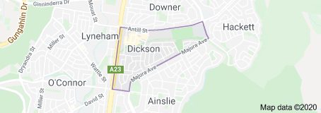 Dickson is a suburb in the Inner North of Canberra, Australia. It is named after Sir James Dickson (1832-1901) who was a Queensland advocate of Australian Federation and one of the founders of the Australian Constitution. There is no specific theme for street names.
The population count of Dickson on census night 2021 was 3,292 people.
Local Groups:
Most Recent 5 Dickson Development Applications
The latest public Environment and Planning Directorate – Planning notifications can also be accessed from their site. The following is an extract of the public applications selected by NCCC that principally relate to Dickson or have an impact on North Canberra or its residents; the extract may not be complete and does not contain development applications that are not publicly notified.
Address: 63 Majura Avenue, Dickson, ACT
View Development Application: 202138962 (if still available)
Brief Desecription: PLANNING ACT 2007-AMENDMENT TO APPROVED DA202138962-S197B. Amendment to the development application for PROPOSAL FOR DWELLING ALTERATIONS AND ADDITIONS - proposed extensions and alterations to existing dwelling, new garage, demolition of existing carport and associated works. - the amendment is to amend roof design, window alterations, internal alterations, increase length of garage and associated works.
Comment closure date: 2024-07-15
Address: 1 Moncrieff Street, Dickson, ACT
View Development Application: 202442923 (if still available)
Brief Desecription: PLANNING ACT 2023 - PROPOSAL FOR MULTI UNIT DEVELOPMENT AND LEASE VARIATION - demolition of the existing dwelling and the construction of 3 new three storey dwellings, basement parking, tree removal, landscaping and associated works. Lease Variation to permit three dwellings.
Comment closure date: 2024-06-20
Address: 110 Cowper Street, Dickson, ACT
View Development Application: 202442980 (if still available)
Brief Desecription: PLANNING ACT 2023 - PROPOSAL FOR ALTERATIONS AND ADDITIONS, SECONDARY RESIDENCE AND LEASE VARIATION - alterations and additions to existing dwelling including replacement of window to a sliding door and new carport, removal of deck roof, construction of a new single storey secondary residence, new carport, landscaping, and associated works. Lease variation to permit secondary residence.
Comment closure date: 2024-06-18
Address: 65 Wilshire Street, Dickson, ACT
View Development Application: 202342620 (if still available)
Brief Desecription: PLANNING ACT 2023 - STAGE 2 NOTIFICATION OF DA202342620 - S179 (PROPOSAL FOR DEMOLITION AND LEASE VARIATION). Second stage of public notification for significant development for (demolition of the existing dwelling, carport, garage, shed and lease variation for subdivision of the block into two blocks.) which is still under consideration by the Authority has had futher information submitted relating to the tree management plan.
Comment closure date: 2024-05-10
Address: 22 Dumaresq Street, Dickson, ACT
View Development Application: 202442872 (if still available)
Brief Desecription: PLANNING ACT 2023 - PROPOSAL FOR DWELLING ALTERATIONS AND ADDITIONS - Partial demolition of existing dwelling, alterations and additions including extension of existing dwelling and associated works.
Comment closure date: 2024-05-08
Downer

Downer is a suburb in Canberra Australia, in the Inner North. The suburb is bounded by Northbourne Avenue, Antill Street and Philip Avenue.
The suburb was gazetted in 1960 and named after Sir John Downer (1844 – 1915) Premier of South Australia and a member of the first Australian Senate in 1901. There is no specific theme for street names.
The buildings which make up the Downer community centre and former shops, were built for the CSIRO in 1930s, and the area now comprising Downer was an agricultural research facility for the CSIRO. The area now comprising the suburb was used between 1939-45 as a plantation for the growth of opium poppy to provide a source for medications in the unavailability of imported supplies. The large pine and gum trees which surround the block around the shops were planted in this time as a wind break for the CSIRO building. Large trees (Camden Woolybutts) along Swinden street were also planted then, as Swinden street was the driveway for the CSIRO building, where it connected to Northbourne Avenue. With the development of the suburb the trees became diseased during the 1980s and a program is underway to replace them with more amenable local varieties of gum. As of September 2008, all but two or three of the older Swinden Street gums have been removed.
Downer has a local oval between Frencham, Melba, Bonython and Bradfield streets, with a shopping centre. However in 2005 the shopping centre was vacant due partly to the poor location of the centre away from major roads. There is also the Canberra Business Centre nearby, which at one time was a school. The Downer Club, which has an observatory, is nearby, although not technically in Downer, on the Dickson side of Antill Street.
The population count of Downer on census night 2021 was 4,296 people.
Local Groups:
Most Recent 5 Downer Development Applications
The latest public Environment and Planning Directorate – Planning notifications can also be accessed from their site. The following is an extract of the public applications selected by NCCC that principally relate to Downer or have an impact on North Canberra or its residents; the extract may not be complete and does not contain development applications that are not publicly notified.
Address: 69 Lea Place, Downer, ACT
View Development Application: 202342574 (if still available)
Brief Desecription: PLANNING & DEVELOPMENT ACT 2007 - PROPOSAL FOR NEW GARAGE - Demolition of the existing garage and the construction of a new garage with a bathroom, and associated works.
Comment closure date: 2024-06-14
Address: 5 Melba Street, Downer, ACT
View Development Application: 202342691 (if still available)
Brief Desecription: PLANNING ACT 2023-PROPOSAL FOR MULTI UNIT DEVELOPMENT AND LEASE VARIATION - demolition of the existing dwelling, construction of 5 new dwellings across two buildings ranging from 2-3 storey's, basement parking, driveway/verge crossing, tree removal, landscaping and associated works. Lease Variation to limit crown lease to five dwellings.
Comment closure date: 2024-05-24
Address: 9 Melba Street, Downer, ACT
View Development Application: 202342693 (if still available)
Brief Desecription: PLANNING ACT 2023-PROPOSAL FOR MULTI UNIT DEVELOPMENT AND LEASE VARIATION - demolition of the existing dwelling, construction of 5 new dwellings across two buildings ranging from 2-3 storey's, basement parking, driveway/verge crossing, tree removal, landscaping and associated works. Lease Variation to limit crown lease to five dwellings.
Comment closure date: 2024-05-24
Address: 7 Melba Street, Downer, ACT
View Development Application: 202342692 (if still available)
Brief Desecription: PLANNING ACT 2023-PROPOSAL FOR MULTI UNIT DEVELOPMENT AND LEASE VARIATION - demolition of the existing single dwelling, construction of 5 new dwellings across two buildings ranging from 2-3 storey's, basement parking, driveway/verge crossing, tree removal, landscaping and associated works. Lease Variation to remove clause 1 (e), and to permit five (5) dwellings.
Comment closure date: 2024-05-24
Address: 558 Northbourne Avenue, Downer, ACT
View Development Application: 202342285 (if still available)
Brief Desecription: PROPOSAL FOR DWELLING ALTERATIONS AND ADDITIONS - Partial demolition and internal alterations of existing dwelling, addition includes a ground and upper floor extension, decking, new front entrance, landscaping and associated works.
Comment closure date: 2023-12-01
Hackett

Hackett is an Inner North suburb of Canberra. It was named after Sir John Winthrop Hackett (1848-1916), who was a newspaper editor and worker for the Federation of Australia. Streets in Hackett are named after scientists.
Hackett is next to Watson, Dickson and Ainslie. It is bounded by Antill street and Philip avenue, and the Canberra Nature Park of Mt Ainslie/Mt Majura, with Mount Majura located behind Hackett to the east. Hackett has a neighbourhood oval, and shopping centre.
The population count of Hackett on census night 2021 was 3,227 people.
Local Groups:
Most Recent 5 Hackett Development Applications
The latest public Environment and Planning Directorate – Planning notifications can also be accessed from their site. The following is an extract of the public applications selected by NCCC that principally relate to Hackett or have an impact on North Canberra or its residents; the extract may not be complete and does not contain development applications that are not publicly notified.
Address: 26, 28 Mills Street, Hackett, ACT
View Development Application: 202442832 (if still available)
Brief Desecription: PLANNING ACT 2023 - PROPOSAL FOR MULTI-UNIT DEVELOPMENT AND LEASE VARIATION - Demolition of the existing dwellings and construction of 7 new two storey townhouses, garages, landscaping, new driveway/verge crossing, tree removal and associated works. Lease Variation to consolidate blocks 16 and 17 and to permit 7 dwellings.
Comment closure date: 2024-05-20
Address: 89 Rivett Street, Hackett, ACT
View Development Application: 202342310 (if still available)
Brief Desecription: PROPOSAL FOR DWELLING ALTERATIONS AND ADDITIONS - proposal for developing an existing dwelling into a multi-generational house by construction of a single-storey extension, refurbishment of existing garage to a multipurpose multigenerational living space, new carport, solar envelope encroachment for the roof of the proposed extensions, landscaping, driveway works and associated works.
Comment closure date: 2023-11-20
Address: 19 Gilbert Street, Hackett, ACT
View Development Application: 202342135 (if still available)
Brief Desecription: PROPOSAL FOR A SECONDARY DWELLING - demolition of an existing garage, and the construction of a new garage, the conversion of an existing garage into a secondary residence, a new carport, a second driveway crossing, and associated works.
Comment closure date: 2023-10-16
Address: 42 Maitland Street, Hackett, ACT
View Development Application: 202342015 (if still available)
Brief Desecription: PROPOSAL FOR NEW PRIMARY AND SECONDARY DWELLING - Construction of a new two storey dwelling and a single storey secondary residence, driveway works, garages, landscaping and associated works
Comment closure date: 2023-09-27
Address: 23 Brennan Street, 62 Mackenzie Street, Hackett, ACT
View Development Application: 202341832 (if still available)
Brief Desecription: PROPOSAL FOR A DUAL OCCUPANCY - seeking retroactive approval for an expired development application for a dual occupancy, basement parking, swimming pools, landscaping and associated works.
Comment closure date: 2023-08-04
Lyneham

Lyneham is a suburb of Canberra, in the Australian Capital Territory. It is named after Sir William Lyne, premier of the Australian state of New South Wales from 1899 to 1901. The suburb was gazetted in 1928, but development did not commence until 1958. Like many other suburbs in inner Canberra, it is currently undergoing gentrification.
The population count of Lyneham on census night 2021 was 5,703 people.
Community Groups:
Most Recent 5 Lyneham Development Applications
The latest public Environment and Planning Directorate – Planning notifications can also be accessed from their site. The following is an extract of the public applications selected by NCCC that principally relate to Lyneham or have an impact on North Canberra or its residents; the extract may not be complete and does not contain development applications that are not publicly notified.
Address: 127 Goodwin Street, Lyneham, ACT
View Development Application: 202443059 (if still available)
Brief Desecription: PLANNING ACT 2023 - PROPOSAL FOR DWELLING ALTERATIONS AND ADDITIONS - Demolition of existing garage and pergola, construction of a single storey extension, garage, landscaping, and associated works.
Comment closure date: 2024-07-08
Address: 56 Lewin Street, Lyneham, ACT
View Development Application: 202442879 (if still available)
Brief Desecription: PLANNING ACT 2023 - PROPOSAL FOR ADDITIONS AND ALTERATIONS TO EXISTING RESIDENCE - Construction of a new courtyard, remove and replace existing porch, new garage, internal alterations, additions and new deck to rear of block and associated works.
Comment closure date: 2024-06-07
Address: 125 Brigalow Street, Lyneham, ACT
View Development Application: 202442921 (if still available)
Brief Desecription: PLANNING ACT 2023 - PROPOSAL FOR DWELLING ALTERATIONS AND ADDITIONS - partial demolition of the existing dwelling, shed and tree removal. Construction of ground floor extension, internal alterations, new carport, pergola, deck, new fence and gate, landscaping, and associated works.
Comment closure date: 2024-05-17
Address: 11 Dyson Street, Lyneham, ACT
View Development Application: 202442699 (if still available)
Brief Desecription: PLANNING ACT 2023-PROPOSAL FOR DUAL OCCUPANCY AND LEASE VARIATION - demolition of the existing dwelling, garage, driveway and tree removal. Construction of new two storey dwellings, garages, landscaping, courtyard wall, and associated works. LEASE VARIATION to permit two dwellings.
Comment closure date: 2024-05-17
Address: 7 Wattle Place, Hall Street , Lyneham, ACT
View Development Application: 202241028 (if still available)
Brief Desecription: PLANNING & DEVELOPMENT ACT 2007 - PROPOSAL FOR ALTERATIONS AND ADDITIONS TO COMMERCIAL DEVELOPMENT AND LEASE VARIATION - Partial demolition and extension to existing shop, alterations and additions including new accessible entrance and awning, signage and associated works. Lease Variation to increase the allowable GFA and modification of access easement to accommodate proposed extension.
Comment closure date: 2024-04-24
O'Connor

O’Connor is an Inner North suburb in Canberra, Australia. It lies between the suburbs of Lyneham and Turner. It was named after Richard Edward O’Connor (1851-1912), who was a judge in the High Court and a founder of the Australian constitution. Street names in O’Connor are named after explorers, Australian flora, legislators and pioneers. The suburb was gazetted on 20 September 1928.
O’Connor is bounded by Wattle and David streets, and also includes the Bruce/O’Connor ridge nature reserve, the hilly area with many trees that lies between the houses in O’Connor, and the Australian Institute of Sport. Sports such as soccer, rugby and cricket are often played at the ovals at O’Connor district playing fields.
O’Connor has a small shopping center with a pub/bar, supermarket, a couple of restaurants and a pharmacy. The YHA youth hostel which was previously located in Dryandra street in O’Connor, relocated to 7 Akuna Street in Civic.
The population count of O’Connor on census night 2021 was 5,917 people.
Local Community Groups:
O’Connor Community Association
Most Recent 5 O’Connor Development Applications
The latest public Environment and Planning Directorate – Planning notifications can also be accessed from their site. The following is an extract of the public applications selected by NCCC that principally relate to O’Connor or have an impact on North Canberra or its residents; the extract may not be complete and does not contain development applications that are not publicly notified.
Address: 20 Kunzea Street, O'connor, ACT
View Development Application: 202342653 (if still available)
Brief Desecription: PLANNING ACT 2023 - PROPOSAL FOR COMMERCIAL DEVELOPMENT - Demolition of the existing restaurant and construction of a new two storey restaurant building, alterations to existing pavement and road, landscaping and associated works.
Comment closure date: 2024-06-24
Address: 15 David Street, O'connor, ACT
View Development Application: 202442800 (if still available)
Brief Desecription: PLANNING ACT 2023 - PROPOSAL FOR MULTI-UNIT RESIDENTIAL DEVELOPMENT AND LEASE VARIATION - Demolition of existing single dwelling and associated structures, construction of multi unit residential building comprising of 3 three-storey dwellings with associated garages, tree removal, landscaping and associated works. Lease variation to permit 3 dwellings.
Comment closure date: 2024-06-12
Address: 56 Dryandra Street, O'connor, ACT
View Development Application: 202442753 (if still available)
Brief Desecription: PLANNING ACT 2023 - PROPOSAL FOR ALTERATIONS AND ADDITIONS TO EXISTING COMMUNITY FACILITY DEVELOPMENT - construction of a of new detached 6m x 9m classroom and associated works.
Comment closure date: 2024-04-30
Address: 29 Waratah Street, O'connor, ACT
View Development Application: 202342093 (if still available)
Brief Desecription: PROPOSAL FOR DUAL OCCUPANCY AND LEASE VARIATION - demolition of the existing dwelling, construction of 2 new two storey dwellings to form a dual occupancy, attached double garages, alfrescos, swimming pools, landscaping, a new driveway, tree removal, landscaping and associated works. Lease Variation to permit two dwellings.
Comment closure date: 2023-10-16
Address: 8 Brigalow Street, O'connor, ACT
View Development Application: 202342050 (if still available)
Brief Desecription: PROPOSAL FOR NEW SWIMMING POOL AND DECK - partial demolition of existing retaining wall, construction of swimming pool, deck, retaining wall, pool fence and associated works.
Comment closure date: 2023-09-28
Pialligo

Pialligo (postcode: 2609) is a rural suburb of Canberra, Australian Capital Territory, Australia. The name Pialligo has been used for the area since at least 1820, and is probably of Aboriginal origin. It was also the name for the parish in the area. Streets in Pialligo are named with Aboriginal words.
Beltana Road in Pialligo is home to many of Canberra’s nurseries. Canberra International Airport is located adjacent to Pialligo across Pialligo Avenue.
The population count of Pialligo on census night 2021 was 138 people.
Most Recent 5 Pialligo Development Applications
The latest public Environment and Planning Directorate – Planning notifications can also be accessed from their site. The following is an extract of the public applications selected by NCCC that principally relate to Pialligo or have an impact on North Canberra or its residents; the extract may not be complete and does not contain development applications that are not publicly notified.
Address: 14 Beltana Road, Pialligo, ACT
View Development Application: 202341629 (if still available)
Brief Desecription: PROPOSAL TO VARY A CROWN LEASE - Proposal to vary the purpose clause in the Crown lease to increase the maximum permitted gross floor area, for the existing ancillary use of restaurant, to 250m².
Comment closure date: 2023-06-29
Address: 15 Beltana Road, Pialligo, ACT
View Development Application: 202240656 (if still available)
Brief Desecription: PROPOSAL FOR DWELLING ALTERATIONS AND ADDITIONS - retroactive approval for existing works including shed, roof coverings, gazebo, covered walkway, courtyard roof, verge crossing, and associated works.
Comment closure date: 2022-11-30
Address: 20 Kallaroo Road, Pialligo, ACT
View Development Application: 202240167 (if still available)
Brief Desecription: PROPOSAL FOR DWELLING ALTERATIONS - Retrospective approval sought for internal renovations to existing building and associated works - to enable a change to the building class to Class 1B.
Comment closure date: 2022-06-15
Address: Corner Of Beltana Road And Kallaroo Road, Pialligo, ACT
View Development Application: 202139639 (if still available)
Brief Desecription: PROPOSAL FOR ROAD WORKS - construction of roadside car parking and pedestrian facilities along Beltana Road, new intersection between Beltana Road and Pialligo avenue, and associated works.
Comment closure date: 2022-06-09
Address: 14 Beltana Road, Pialligo, ACT
View Development Application: 202138293 (if still available)
Brief Desecription: PROPOSAL FOR MIXED USE COMMERCIAL DEVELOPMENT - Construction of Caf/restaurant, farm training facility, produce market, guest house, landscaping and associated works.
Comment closure date: 2021-05-13
Reid

Reid is a suburb of Canberra, Australian Capital Territory, Australia. Located directly next to Civic, Canberra’s central business district, Reid is one of the oldest suburbs in Canberra. The population of Reid on census night 2021 was 1,544 people.
Reid is named after Australia’s fourth Prime Minister, Sir George Reid.
Separating the suburbs of Reid and Campbell is ANZAC Parade a ceremonial boulevarde, running along Canberra’s primary design axis (the ceremonial axis) from Lake Burley Griffin to the Australian War Memorial.
Located in Reid are the Canberra Institute of Technology and St John the Baptist Church, the oldest church in Canberra. Most of Reid is a protected Historical Precinct.
Local Community Groups
Most Recent 5 Reid Development Applications
The latest public Environment and Planning Directorate – Planning notifications can also be accessed from their site. The following is an extract of the public applications selected by NCCC that principally relate to Reid or have an impact on North Canberra or its residents; the extract may not be complete and does not contain development applications that are not publicly notified.
Address: Unit 24 - 56/1 Kogarah Lane, Reid, ACT
View Development Application: 202443062 (if still available)
Brief Desecription: PLANNING ACT 2023 - PROPOSAL FOR DWELLING ALTERATIONS AND ADDITIONS - Seeking retrospective approval for alterations and additions including extensions of bedroom and kitchen space, reclamation of roof cavity for storage and associated works.
Comment closure date: 2024-07-16
Address: 47 Coranderrk Street, Reid, ACT
View Development Application: 202443027 (if still available)
Brief Desecription: PLANNING ACT 2023 - PROPOSAL FOR NEW DWELLING - Demolition of existing low height brick wall, construction of a new single storey dwelling with basement, landscaping and associated works.
Comment closure date: 2024-06-21
Address: Unit 22 - 1 Kogarah Lane, Reid, ACT
View Development Application: 202442966 (if still available)
Brief Desecription: PLANNING ACT 2023 - PROPOSAL FOR ALTERATIONS AND ADDITIONS - alterations and additions including proposed lift with walkway, new double glazing windows, and associated works.
Comment closure date: 2024-06-11
Address: 21 Geerilong Gardens, Reid, ACT
View Development Application: 202240480 (if still available)
Brief Desecription: PROPOSAL FOR DWELLING ALTERATIONS AND ADDITIONS - partial demolition of the existing dwelling and alterations and additions including new single storey extension, internal renovations, restoration of the original porch and steps, new pergola and gazebo, landscaping and associated works.
Comment closure date: 2023-07-10
Address: 3 Geerilong Gardens, Reid, ACT
View Development Application: 202341443 (if still available)
Brief Desecription: PROPOSAL FOR DWELLING ALTERATIONS AND ADDITIONS - partial demolition of existing dwelling and metal garden sheds, internal alterations, replacement of windows, doors, garage extension, addition of solar PV panels, landscaping and associated works.
Comment closure date: 2023-05-26
Russell
** Note - Russell does not have a unique poistcode.

Russell, an inner north suburb in Canberra, Australia. Russell is one of the smallest suburbs in Canberra, comprising a number of government offices but no private residences. It is probably best known for the headquarters of the Australian Defence Force, which is housed in the Russell Offices complex.
It is bounded by Morshead Drive, Parkes Way, Borella Street and Constitution Avenue. Mount Pleasant lies just to the east, between Russell and Duntroon which are part of the suburb of Campbell. The Australian American War Memorial is located in Russell. To the west lies Kings Park and Grevillea Park, on the shore of Lake Burley Griffin.
Russell did not have any residents in the 2021 census.
Local Community Groups
Most Recent Russell Development Applications
The latest public Environment and Planning Directorate – Planning notifications can also be accessed from their site. The following is an extract of the public applications selected by NCCC that principally relate to Russell or have an impact on North Canberra or its residents; the extract may not be complete and does not contain development applications that are not publicly notified.
Invariably, due to Russell being a defence precinct, there may be no DAs.
Turner

Turner (postcode: 2612) is a leafy early Canberra suburb, close to Civic and the Australian National University (located south in Acton). The population of Turner on census night 2021 was 4,470 people.
Turner is named after Sir George Turner, a Federalist, legislator and one of the founders of the Australian Constitution. He was a Premier of Victoria, and later Federal Treasurer under prime ministers Barton, Deakin and Reid. Streets in Turner are mostly named after writers, legislators and pioneers
Local Groups:
- Turner Residents Association
Most Recent 5 Turner Development Applications
The latest public Environment and Planning Directorate – Planning notifications can also be accessed from their site. The following is an extract of the public applications selected by NCCC that principally relate to Turner or have an impact on North Canberra or its residents; the extract may not be complete and does not contain development applications that are not publicly notified.
Address: 17 Hackett Gardens, Turner, ACT
View Development Application: 202443023 (if still available)
Brief Desecription: PLANNING ACT 2023 - PROPOSAL FOR BUILDING SECONDARY RESIDENCE - Conversion of the existing studio into a secondary residence with the construction of a kitchen and associated works.
Comment closure date: 2024-07-10
Address: 6 Watson Street, Turner, ACT
View Development Application: 202342541 (if still available)
Brief Desecription: PLANNING AND DEVELOPMENT ACT 2007 - PROPOSAL FOR DEMOLITION AND LEASE VARIATION - Demolition of existing building and associated works. Lease Variation to allow for residential use limited to 45 multi-unit housing dwellings, supportive housing use limited to 10 dwellings with café, consulting room and common area uses ancillary to supportive housing and to remove 'club' as a use from the Crown lease.
Comment closure date: 2024-06-06
Address: 6 Watson Street, Turner, ACT
View Development Application: 202342545 (if still available)
Brief Desecription: PLANNING AND DEVELOPMENT ACT 2007 - LEASE VARIATION - To remove the concessional status from the Crown lease only.
Comment closure date: 2024-06-06
Address: 49 Forbes Street, 1 Wedge Crescent, Turner, ACT
View Development Application: 202342088 (if still available)
Brief Desecription: PROPOSAL FOR DUAL OCCUPANCY AND LEASE VARIATION - demolition of the existing dwelling, construction of 2 new three storey dwellings to form a dual occupancy, garages, tree removal, landscaping and associated works. Lease Variation to permit two (2) dwellings.
Comment closure date: 2023-12-08
Address: Unit 8, 40 Macleay Street, Turner, ACT
View Development Application: 202342293 (if still available)
Brief Desecription: PROPOSAL FOR ALTERATIONS AND ADDITIONS - Conversion of existing unit eight garage into habitable living space, replace roller door with window and associated works.
Comment closure date: 2023-12-01
Watson

Watson is a suburb in the North Canberra district of Canberra, the so-called “Inner North”. Watson is named in honour of the third Prime Minister of Australia John Christian Watson, and was gazetted on 7 April 1960. Streets in Watson are named after Australian judges and other legal professionals. As of the 2021 Australian census the population of Watson was 6,727.
Watson is bordered by the Federal Highway, Philip Avenue and Antill Street. It lies next to the suburbs of Downer and Hackett. Behind Hackett is Mount Majura on the Canberra Nature Park.
Watson has a shopping centre, and the AIE originally Watson High School located nearby. Rosary catholic school is located in Watson, as is the Signadou campus of the Australian Catholic University. There is also Majura primary government school which is well known for its popular annual Spring Carnival a preschool a child care centre and a doctor’s surgery. There once was a drive-in theatre (The starlight) in Watson. Currently, North Watson is undergoing the construction of Majura Rise, a new estate south of the television studios listed below. This area is walking distance from Mount Majura, along with many other facilities. It is expected this area will increase the property value of Watson. Also located in the suburb are the Ten and Prime television studios,The Ted Noffs Foundation, Canberra Carotel, Australian Heritage Village (now closed), service station and Health Services Hostel.
Local Groups:
- Watson Community Association
- North Watson Land Use Master Plan
- EPIC tourist accommodation proposal
- National Capital Village redevelopment
- Redevelopment of the Australian Heritage Village in Watson (DV261)
- Regent Honeyeater Study Paper
- Transforming Watson Oval
- Watson Woodlands Working Group
Most Recent 5 Watson Development Applications
The latest public Environment and Planning Directorate – Planning notifications can also be accessed from their site. The following is an extract of the public applications selected by NCCC that principally relate to Watson or have an impact on North Canberra or its residents; the extract may not be complete and does not contain development applications that are not publicly notified.
Address: 52 Knox Street, Watson, ACT
View Development Application: 202442965 (if still available)
Brief Desecription: PLANNING ACT 2023 - PROPOSAL FOR A SECONDARY RESIDENCE - Demolition of the existing carport, construction of a new single storey secondary residence in addition to the existing dwelling, new carport, driveway, landscaping, and associated works.
Comment closure date: 2024-06-12
Address: 25 Manning Street, Watson, ACT
View Development Application: 202342292 (if still available)
Brief Desecription: PROPOSAL FOR GARAGE - construction of a new garage and associated works.
Comment closure date: 2023-11-24
Address: 153 Knox Street, Watson, ACT
View Development Application: 202342232 (if still available)
Brief Desecription: PROPOSAL FOR NEW DWELLING - demolition of the existing dwelling and construction of a new two storey dwelling, garage, driveway/verge crossing, landscaping and associated works.
Comment closure date: 2023-11-02
Address: 34 Windeyer Street, Watson, ACT
View Development Application: 202342097 (if still available)
Brief Desecription: PROPOSAL FOR ALTERATIONS AND ADDITIONS TO EXISTING MEDICAL CENTRE - Partial demolition of the existing building, extension to building for new rooms, new wheelchair lift, removal of demountable, and associated works.
Comment closure date: 2023-10-17
Address: 350 Antill Street, Watson, ACT
View Development Application: 202341979 (if still available)
Brief Desecription: PROPOSAL FOR HOSPITAL - Demolition of existing buildings and tree removal, construction of a two storey rehabilitation facility to the north of block and construction of four one and two storey buildings to make up new health hub to the south of block, new driveway verge crossings and internal driveway, parking area, outdoor recreation areas, signage, landscaping and associated works.
Comment closure date: 2023-10-09